
Loading

Search
▼ Heavy Rain, Soaring Temperatures Forecast For Wide Areas Of Japan
- Category:Nature
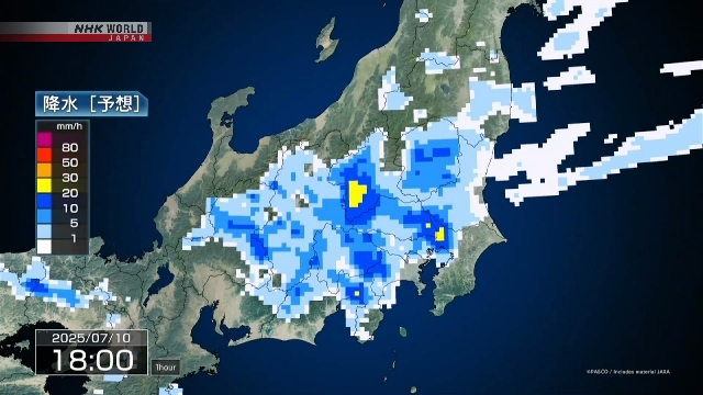
A tropical depression in the East China Sea is forecast to approach the Kyushu region in southwest Japan toward Monday, bringing intense rainfall mainly to western Japan.
The Japan Meteorological Agency says warm, moist air is flowing from the south into the system, which is heading east. Rainclouds are developing in some parts of southern Kyushu and the Amami region of Kagoshima Prefecture.
The depression is expected to bring heavy rain and thunderstorms to these areas on Sunday.
With more humid air streaming in from Monday onwards, torrential rain could hit western Japan toward Monday and the Pacific coast side of eastern Japan on Tuesday.
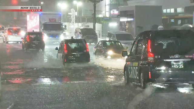
Weather officials are calling for caution over landslides, flooding of low-lying areas and swollen rivers.
Meanwhile, temperatures are soaring in western Japan and elsewhere with 35 degrees Celsius or higher being registered in some locations.
Daytime highs will be 37 degrees in Osaka City; 36 degrees in Kyoto City, Takamatsu City, Tottori City and Fukui City; and 35 in Fukuoka City, Hiroshima City, Nagoya City and Nagano City.
The Japan Meteorological Agency says warm, moist air is flowing from the south into the system, which is heading east. Rainclouds are developing in some parts of southern Kyushu and the Amami region of Kagoshima Prefecture.
The depression is expected to bring heavy rain and thunderstorms to these areas on Sunday.
With more humid air streaming in from Monday onwards, torrential rain could hit western Japan toward Monday and the Pacific coast side of eastern Japan on Tuesday.
Weather officials are calling for caution over landslides, flooding of low-lying areas and swollen rivers.
Meanwhile, temperatures are soaring in western Japan and elsewhere with 35 degrees Celsius or higher being registered in some locations.
Daytime highs will be 37 degrees in Osaka City; 36 degrees in Kyoto City, Takamatsu City, Tottori City and Fukui City; and 35 in Fukuoka City, Hiroshima City, Nagoya City and Nagano City.
Heatstroke alerts have been issued for a number of prefectures in western and southwestern Japan.
Looking eastward, Tropical Storm Nari is now approaching Japan's Ogasawara Islands and is expected to come close to eastern and northern Japan on Monday.
The meteorological agency says the tropical storm was spawned early Sunday and was heading north-northeast at 20 kilometers per hour as of Sunday noon in waters 100 kilometers east-southeast of Chichijima Island in the island chain.
It has a central atmospheric pressure of 994 hectopascals and is packing winds of up to 72 kilometers per hour near its center, with gusts of up to 108 kilometers per hour.
Strong winds of over 54 kilometers per hour are blowing within 440 kilometers on its southeastern side and within 165 kilometers on its northwestern side.
Nari is projected to move northward while strengthening and to approach eastern and northern Japan on Monday.
Due to warm and moist air flowing into the storm, torrential rain or thunderstorms may hit the Ogasawara Islands toward Monday, and the Kanto region, including Tokyo, the Izu Islands and the Tohoku region on Monday.
Weather officials are calling on people in the storm's path to be on the alert for landslides, flooding of low-lying areas and swollen rivers, as well as strong winds and high waves. They are also advising caution against lightning strikes and gusting winds.
- July 13, 2025
- Comment (0)
- Trackback(0)