
Loading

Search
▼ Typhoon Hinnamnor Forecast To Re-Approach Okinawa On Sunday
- Category:Nature
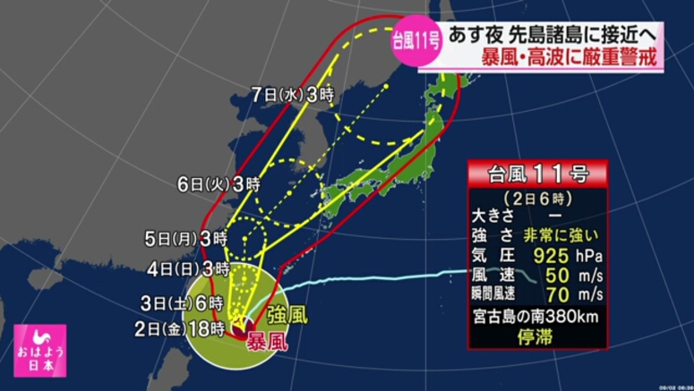
Typhoon Hinnamnor is expected to re-approach Japan's southern prefecture of Okinawa on Sunday.
The Japan Meteorological Agency says that as of 3 a.m. on Friday, the "very strong" typhoon was almost stationary over waters about 390 kilometers south of Okinawa's Miyakojima Island.
Hinnamnor was packing winds of up to 180 kilometers per hour near its center and gusts of up to 252 kilometers per hour.
The storm is expected to stay south of Okinawa through Saturday night before moving north. It is predicted to get very close to the prefecture's Sakishima Islands early on Sunday morning.
Hinnamnor is forecast to bring intense winds that could destroy some homes on the islands.
Agency officials say people should brace for violent winds and rough seas.
Later, it could move further north over the East China Sea and approach the Kyushu region and other parts of western Japan through the middle of next week.
Meanwhile, a rain front and damp air have destabilized atmospheric conditions over western and eastern Japan. Some parts of the regions could be hit by downpours.
Weather officials are calling on people to stay vigilant for mudslides, floods and swollen rivers as well as lightning and gusts.
- September 2, 2022
- Comment (0)
- Trackback(0)