
Loading

Search
▼ Severe Tropical Storm Chanthu Approaching Japan
- Category:Other
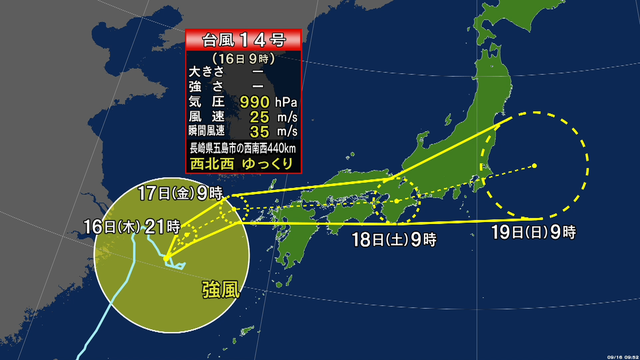
Severe tropical storm Chanthu is expected to approach Japan. Weather officials are advising people to be on the alert for landslides, strong winds and high waves in the west of the country.
Rough weather is also expected in wide areas from northern to western Japan through Saturday.
The Meteorological Agency says Chanthu was hovering over the East China Sea, but is now slowly moving northwest. It is expected to gradually change its course and approach the Tsushima Strait.
Chanthu is expected to become a low-pressure system on Friday morning, with rain and winds gradually intensifying in western Japan.
Precipitation in the 24 hours through Friday morning could reach 150 millimeters in the Shikoku region, 120 millimeters in southern Kyushu, and 100 millimeters in northern Kyushu.
Rainfall for the 24 hours through Saturday morning is expected to reach 200 to 300 millimeters in the Shikoku, Kinki and Tokai regions. It could also reach 100 to 200 millimeters in northern Kyushu and Chugoku, and 100 to 150 millimeters in southern Kyushu.
The officials warn that violent winds are possible in wide areas. Stormy winds and rough seas are expected in western Japan from Friday through Saturday.
The officials also expect the winds to get stronger in northern and eastern Japan, and are calling for caution against violent winds and high waves.
- September 16, 2021
- Comment (0)
- Trackback(0)